$18,025.66
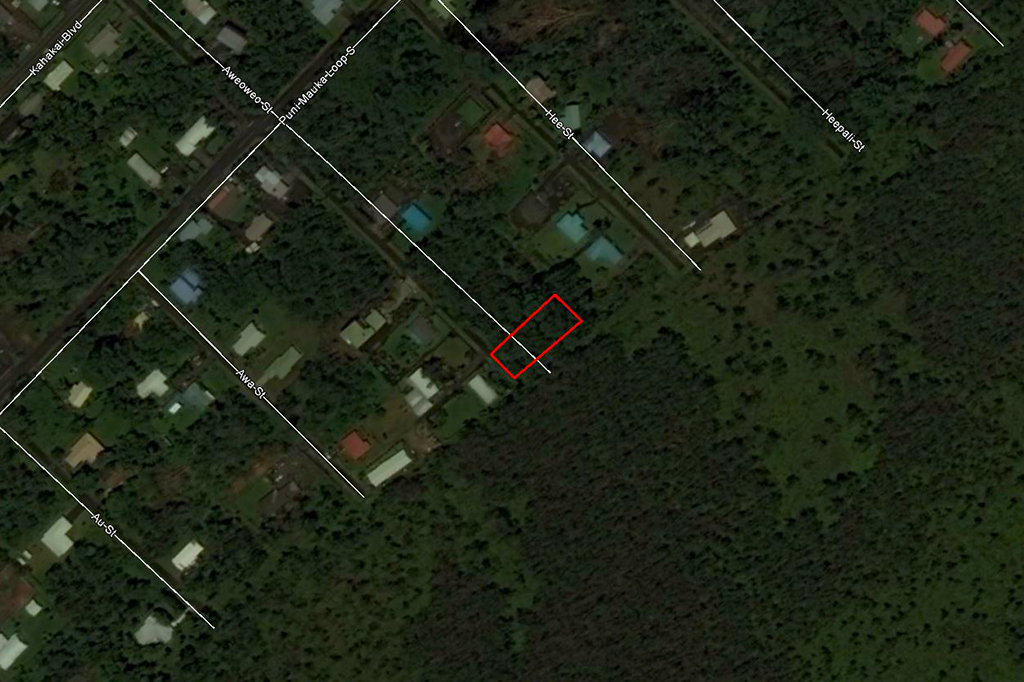
0.33 acres | Residential Zoning
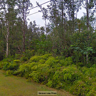
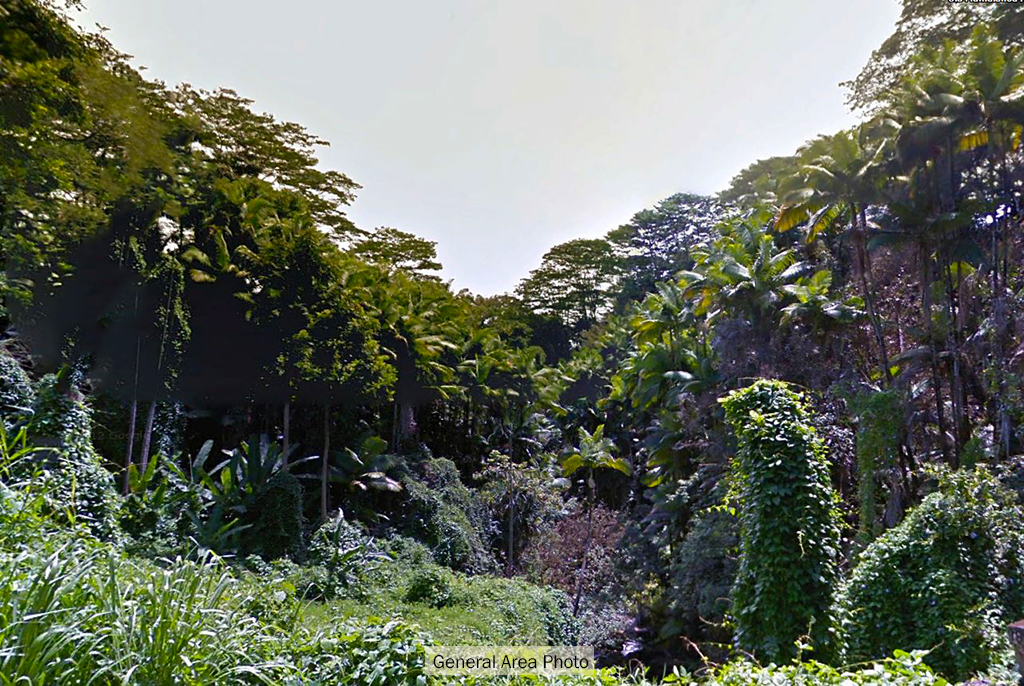
When you think of Hawaii, you think of paradise. Why not own a piece of your own paradise today? This quaint just over three tenths of an acre lot may just allow you to own such a paradise. The lot is very tree covered but this allows you to leave up the ones you want to leave when building your paradise. There is power very close, but will need to be drawn into the lot. The area is very lush and full of greenery and has a lot of close by neighbors. Take a chance and start building your very own paradise now, something to call your own.
Land Specifics Foreclosed
| Property Number | 8856 |
|---|---|
| Size | 0.33 acres |
| Dimensions | 71 X 193 |
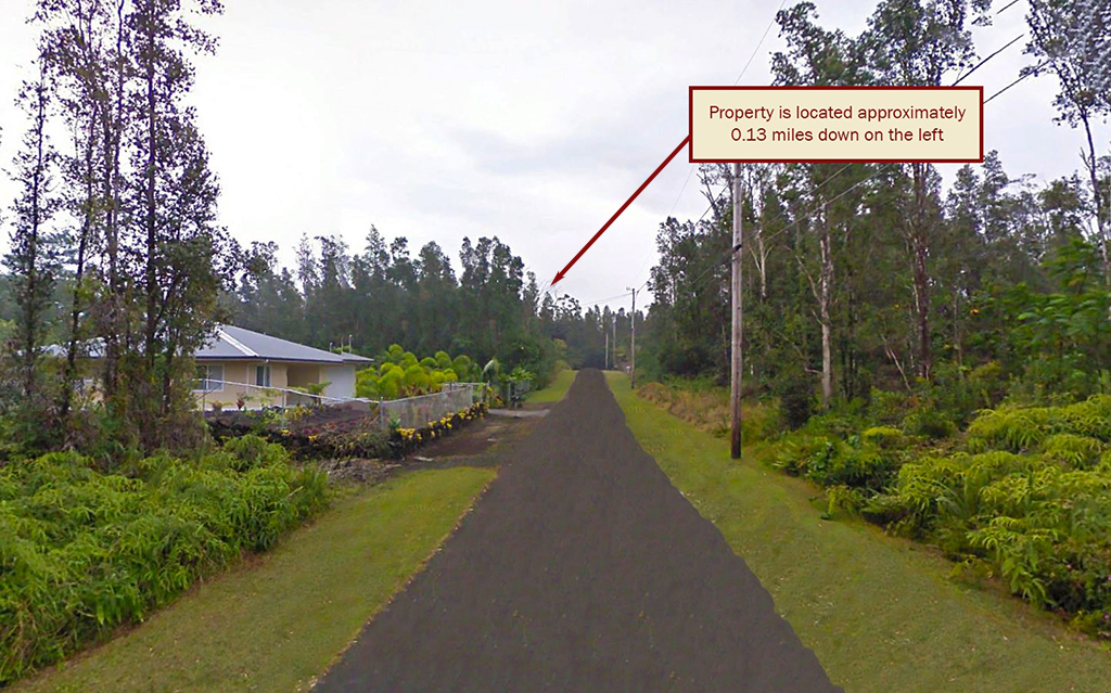
| Road Access | Paved Road |
| Slope Description | Mostly Flat |
| Zoning | Residential |
| Zoning Code | 5A (Agricultural Residential) |
| Zoning Definition |
5A (Agricultural Residential): A single family dwelling allowed not to exceed 35ft in height. An Ohana dwelling may be located on any building site in RA district. |
| On Property Usage/Potential |
|
| Nearby Usage |
|
Location
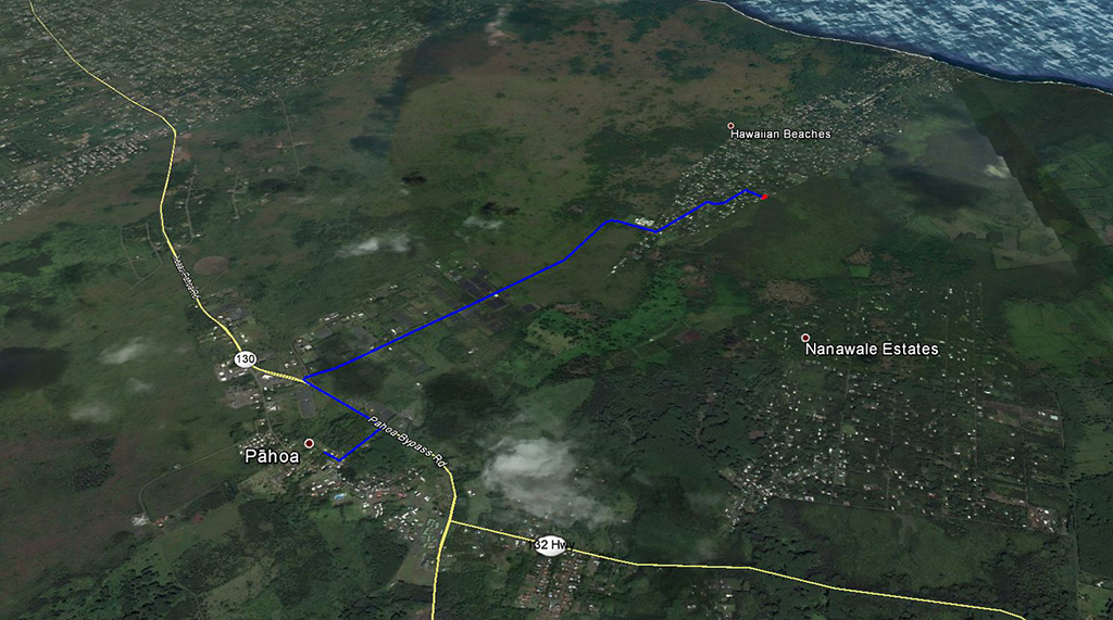
| County | Hawaii |
|---|---|
| State | Hawaii |
| Other Maps |
|---|
Additional Information
| Assessor Parcel Number (APN) | 3 1 5 102 041 0000 |
|---|---|
| Estimated Annual Taxes | $215.34 |
| Legal Description |
TMK(3) 1-5-102-041: All of that certain parcel of land situated at Waiakahiula, in the District of Puna, Island and County of Hawaii, State of Hawaii, described as follows: Lot No. 268, of the “Hawaiian Shores Subdivision” as shown on File Plan No. 737, Document No. 2005-224008, in the Bureau of Conveyances of the State of Hawaii, and containing an area of 14,233 square feet, more or less. Together with any easements or rights of way into the above described premises over Easements “A” and “B” as shown on the map of Hawaiian Shores Subdivision (File Plan No. 737). Being the Premises acquired by Quit Claim Deed Grantor: Lakefront Enterprises, LLC, a Property Rental & Development Partnership, whose address is 1606 Monterey Road, Suite 130, Morgan Hill, CA. 95037. Grantee: Kevin Adair Keifer and Danna Kathleen Keifer, husband & wife, whose address is 1340 Meridian Ave., San Jose, CA. 95125. Dated: March 4, 2010 Recorded: Document No. 2010-173446 Subject to: The terms and provisions, including the failure to comply with any covenants, conditions and reservations, contained in the following: INSTRUMENT: DECLARATION DATED: July 15, 1971 RECORDED: Liber 7675 Page 339 Said Declaration was amended by instruments dated September 8, 1971, recorded in Liber 7786 at Page 332, and dated March 9, 1992, recorded as Document No. 92-037702. Said Declaration was further amended and restated by instrument dated March 7, 1990, recorded as Document No. 90-038745. Said Declaration was further amended by instruments dated March 9, 1992, recorded as Document No. 92-037702, dated February 26, 1996, recorded as Document No. 96-030058, dated March 5, 1999, recorded as Document No. 99-051652, dated May 3, 2000, recorded as Document No. 2000-063120, dated May 15, 2001, recorded as Document No. 2001-086118, dated September 24, 2001, recorded as Document No. 2001-167655, and dated May 15, 2003, recorded as Document No. 2003-112337. 2. EASEMENT “A-11”, 5-feet wide PURPOSE: For underground water pipeline purpose as set forth in Declaration of Easements dated November 29, 1971, recorded in Liber 7974 at Page 358, as amended by instrument dated March 20, 1972, recorded in Liber 8199 at Page 435. 3. EASEMENT “B-17”, 5-feet wide. PURPOSE: for landscaping and planting purposes as set forth in Declaration of Easements dated November 29, 1971, recorded in Liber 7974 at Page 358, as amended by instrument dated March 20, 1972, recorded in Liber 8199 at Page 435. 4. Unrecorded right-of-entry dated April 7, 1978, to install and maintain an electric and telephone easement in favor of Hawaii Electric Light Company, Inc. and GTE Hawaiian Telephone Company Incorporated, now known as Verizon Hawaii, Inc. as mentioned in Quitclaim Deed recorded in Liber 12924 at Page 267, as amended. 5. The terms and provisions, including the failure to comply with any covenants, conditions and reservations, contained in the following: Instrument: HAWAIIAN SHORES COMMUNITY ASSOCIATION BY-LAWS AND DECLARATIONS OF COVENANTS, CONDITIONS AND RESTRICTIONS Dated: September 10, 1979 Recorded: Liber 14819 Page 222 6. The terms and provisions, including the failure to comply with any covenants, conditions and reservations, contained in the following: Instrument: DECLARATION Dated: December 29, 1987 Recorded: Liber 21497 Page 220 |
| Monthly HOA Dues | $35.42 |
| HOA | Hawaiian Shores Community Association |
| HOA Dues | $425 |
| HOA Info | Hawaiian Shores Community Association encompasses over 1,000 residential lots and many common areas including roads, three parks, and a well that provides potable water. There is a pool for members to enjoy and multiple recreational activities such as bingo nights and yoga instruction. |
This property has been sold.
This property is no longer available.
Use My LandCentral to be notified when a similar property is available in the future.
Or search available properties now:
Search Properties