$12,657.00
20 acres | Residential Zoning
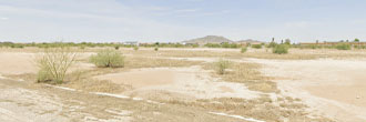
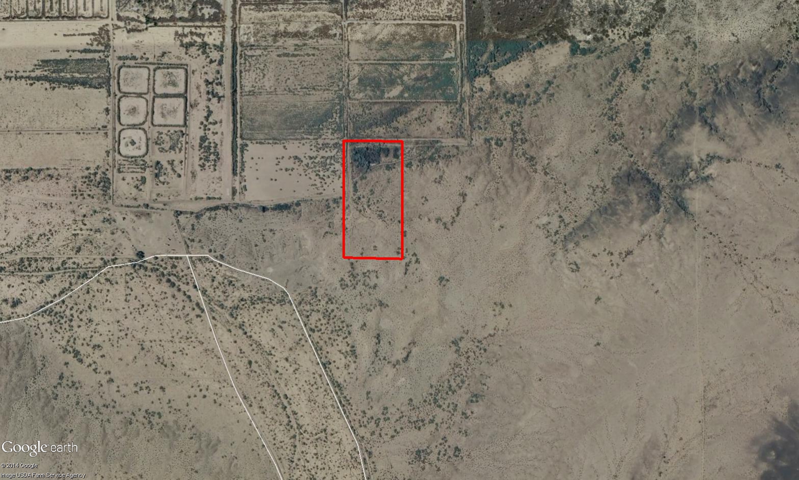
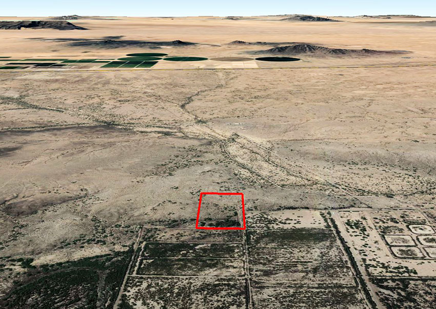
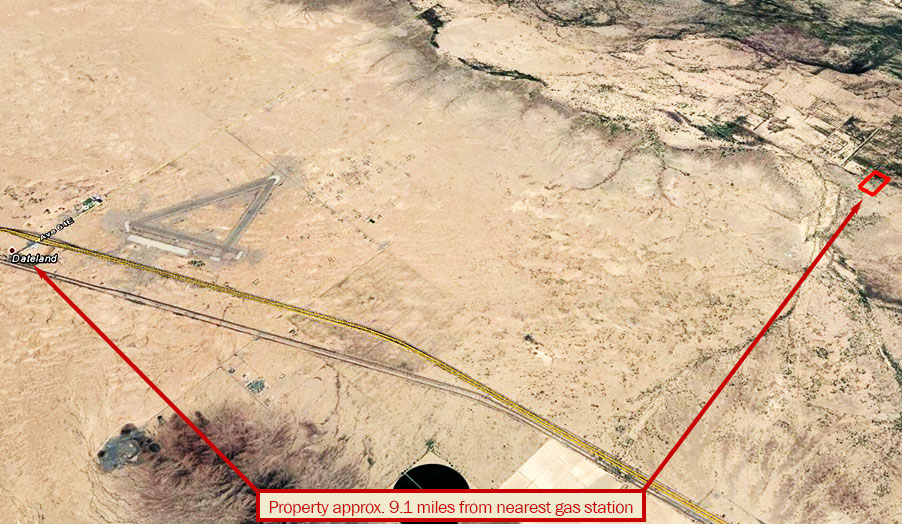
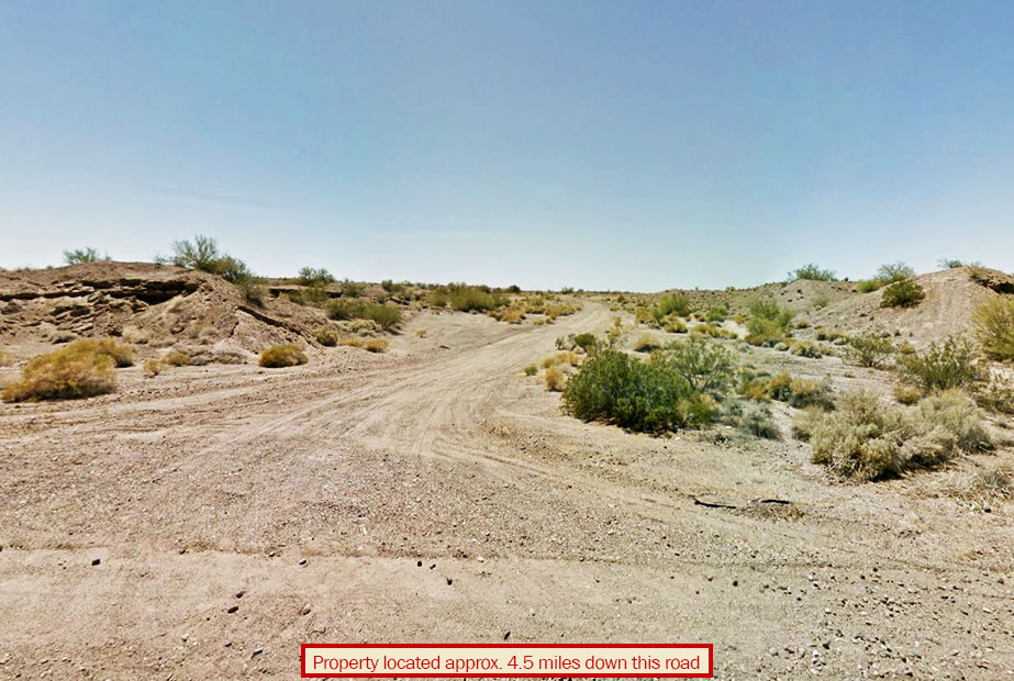
This large 20 acre parcel is located less than 5 miles north of Interstate 8 near the town of Dateland. This property is mostly flat, with less than 30 feet of elevation change over the whole expanse. There are power lines running to the center of the west property line. Although there are no homes in the area, there are farms a few miles to the North. This property has a small stream which runs acros the northern part of the land which probably has water part of the year. In addition, the Gila River is less than 2 miles to the North.
Land Specifics Foreclosed
| Property Number | 8436 |
|---|---|
| Size | 20 acres |
| Dimensions | 660' x 1320' |
| Road Access | Dirt Road |
| Slope Description | Mostly Flat |
| Zoning | Residential |
| Zoning Code | R-1-40 (Low Density Residential) |
| Zoning Definition |
R-1-40 (Low Density Residential): A single family dwelling allowed and accessory buildings, garage/carport/storage shed allowed. Maximum building height not to exceed 35' on any building. Must follow county set back regulations. |
| On Property Usage/Potential |
|
| Nearby Usage |
|
Location
| County | Yuma |
|---|---|
| State | Arizona |
| Other Maps |
|---|
Additional Information
| Assessor Parcel Number (APN) | 165 26 009 |
|---|---|
| Estimated Annual Taxes | $65.48 |
| Legal Description |
The West Half of the Southeast Quarter of the Southwest Quarter of Section 26, Township 6 South, Range 12 West of the Gila and Salt River Base and Meridian, Yuma County, Arizona. Except all minerals as reserved in the Patent recorded as Docket 726, Page 750. |
| Monthly HOA Dues | $0 |
| HOA | |
| HOA Dues | $0 |
| HOA Info |
This property has been sold.
This property is no longer available.
Use My LandCentral to be notified when a similar property is available in the future.
Or search available properties now:
Search Properties