$14,704.25
4.49 acres | Residential Zoning
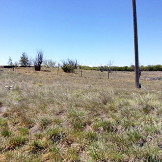
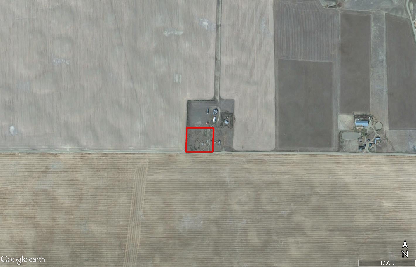
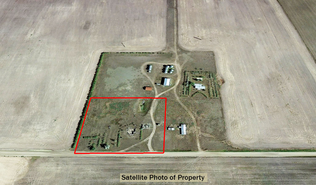
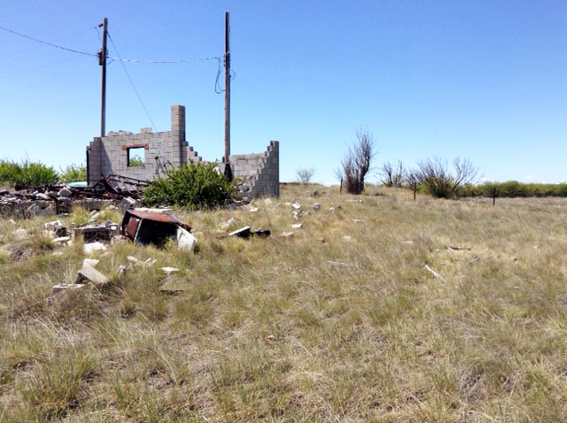
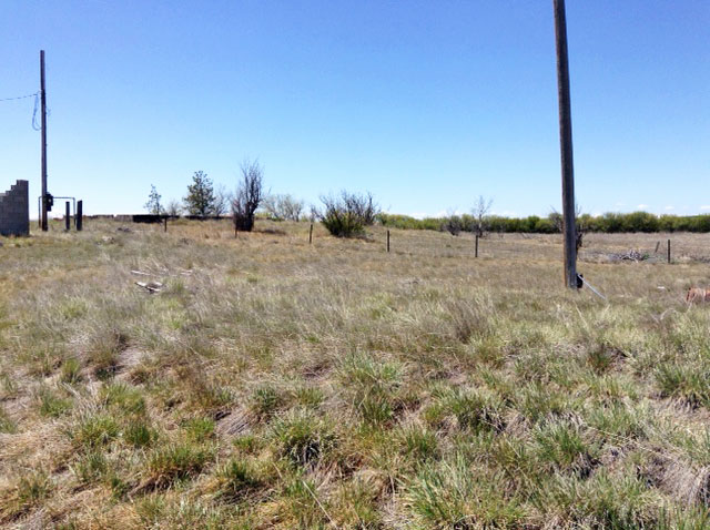
Priced $27,000 BELOW Appraised Value! This farmland parcel of 4.49 acres is less than a mile from Muddy Creek, a few miles upstream from the Teton River. This property is flat and mostly open grassland with some trees planted in a few locations. There are power and telephone poles along the road with is on the East side of the property. This large piece of land also containes the foundation remains of two structures and there is some scrap metal which would need to be cleaned off the property. This is dryland farming country, with the town of Great Falls about an hour away. Glacier National Park is to the northwest. There is fishing, bird and big game hunting in the area. It is a little over 70 miles to the Canadian border.
Land Specifics Foreclosed
| Property Number | 6129 |
|---|---|
| Size | 4.49 acres |
| Dimensions | 471' X 416' |
| Road Access | Paved Road |
| Slope Description | Mostly Flat |
| Zoning | Residential |
| Zoning Code | RR (Residential Rural) |
| Zoning Definition |
RR (Residential Rural): A single family home allowed per lot. Farming and general agricultural activities allowed in conjunction with dwelling. |
| On Property Usage/Potential |
|
| Nearby Usage |
|
Location
| County | Teton |
|---|---|
| State | Montana |
| Other Maps |
|---|
Additional Information
| Assessor Parcel Number (APN) | 0000014825 |
|---|---|
| Estimated Annual Taxes | $584.81 |
| Legal Description |
Township 26 North, Range 2 West, M.P.M., Teton County, Montana Section 32: A tract of land in the South 1/2 of the Southwest 1/4 described as follows: Commencing at the Southwest Section corner of said Section 32; thence South 89 degrees 43'41" East, a distance of 1061.09 feet to the point of beginning; thence continuing South 89 degrees 43'41" East, a distance of 467.71 feet; thence North, a distance of 419.16 feet; thence West, a distance of 467.71 feet; thence South, a distance of 416.94 feet to the point of beginning. As shown and described on Plat #600, recorded June 18, 1998, as Doc. No. 396683, records of Teton County, Montana. Situated in the County of Teton, State of Montana. Prior deed recorded August 25, 2005, Instrument #415478 Bk 130 Pg 0202. |
| Monthly HOA Dues | $0 |
| HOA | |
| HOA Dues | $0 |
| HOA Info |
This property has been sold.
This property is no longer available.
Use My LandCentral to be notified when a similar property is available in the future.
Or search available properties now:
Search Properties