
$36,697.42
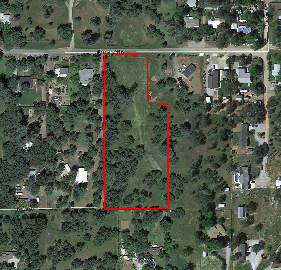
3.5 acres | Residential Zoning
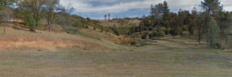
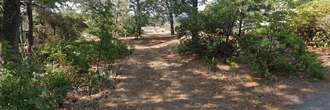
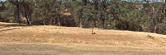
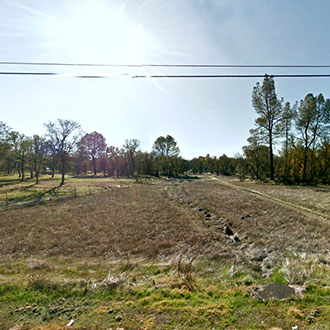
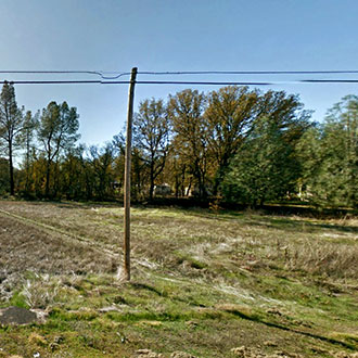
This is a mobile home friendly lot with plenty of greenspace all around. Power lines run along Freeman Way which runs along the North side of the property. This is a nice flat property with a good mix of clear green spaces and trees. This property is located in an established residential area, however, because it is outside of Redding city limits, sewer and waterlines are not supplied by the city. This is a great area for people who like a rural feel but don’t want to be totally off the grid.
Land Specifics Foreclosed
| Property Number | 8607 |
|---|---|
| Size | 3.5 acres |
| Dimensions | 180' x 198.33' x 80' x 431' x 260' x 630' |
| Road Access | Paved Road |
| Slope Description | Mostly Flat |
| Zoning | Residential |
| Zoning Code | IR-T (Interim Rural Residential-Mobile Home) |
| Zoning Definition |
IR-T (Interim Rural Residential-Mobile Home): A single family home allowed per lot to include a mobile and/or manufactured home. Max building height not to exceed 30ft. |
| On Property Usage/Potential |
|
| Nearby Usage |
|
Location
| County | Shasta |
|---|---|
| State | California |
| Other Maps |
|---|
Additional Information
| Assessor Parcel Number (APN) | 054 450 018 |
|---|---|
| Estimated Annual Taxes | $28.70 |
| Legal Description |
The land described herein is situated in the State of California, County of Shasta, unincorporated area, and is described as follows: All that portion of the West One-Half of Section 15, Township 31 North, Range 4 West, MDB&M according to the official plat thereof, described as follows: Commencing at the Northwest Corner of said Section 15, Thence along the West line of said Section 15, Southerly 1980.00 feet; thence parallel with the North line of said Section 15, Easterly 2640.00 feet, more or less, to the East line of said West One-half; thence parallel with said North Line, Westerly 400.00 feet to a point that bears South from the Southeast corner of the parcel described in the deed to E. Earle Horn, Et Ux, recorded October 3, 1962, in Book 720 Page 489, official records; thence Continuing parallel with said North Line, Westerly 264.00 feet to the TRUE POINT OF BEGINNING of this description; thence North 431.67 feet to a point in the Westerly prolongation of the South Line of said Horn parcel; thence, parallel with the North line of said Section 15, Westerly 80.00 feet; thence North 198.33 feet to the Southerly line of the right of way described in the deed to the County of Shasta recorded July 17, 1956, in Book 499, Page 496; thence, along said Southerly line, Westerly to the East line and its northerly prolongation of the parcel described in the deed to Donald W. Kraft, Et Ux, recorded September 27, 1967, in Book 930 Page 485, official records; thence along said East line and Northerly prolongation Southerly 630.00 feet to the South Line of the Parcel described in the deed to William R. Baugh, Et Ux, recorded March 24, 1970, in Book 1023 Page 167 Official Records; thence along said South line Easterly 260.00 feet, more or less, to the True Point of Beginning. |
| Monthly HOA Dues | $0 |
| HOA | |
| HOA Dues | $0 |
| HOA Info |
This property has been sold.
This property is no longer available.
Use My LandCentral to be notified when a similar property is available in the future.
Or search available properties now:
Search Properties