$13,997.00
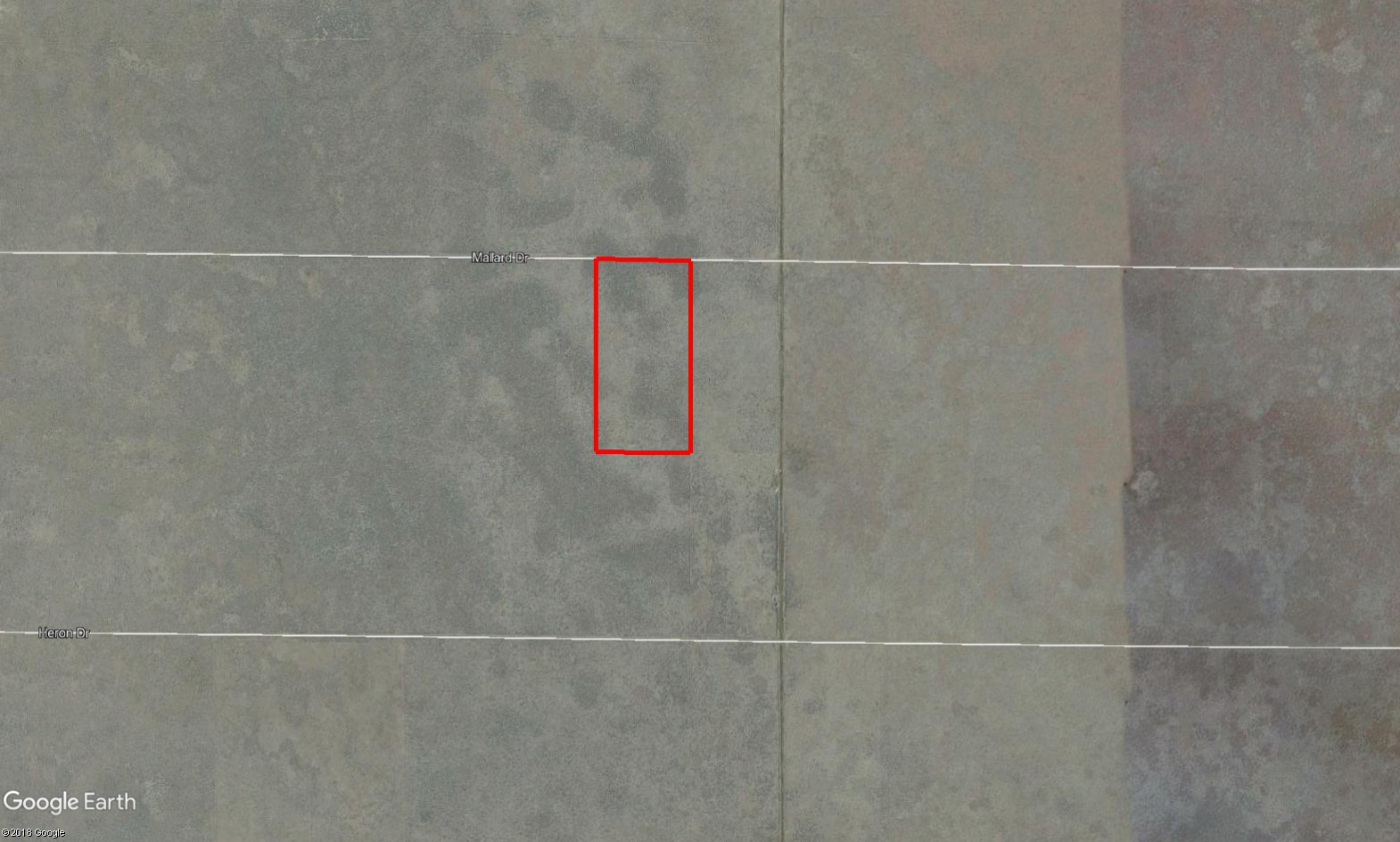
20.20 acres | Forest / Conservation Zoning
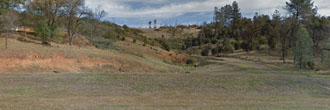
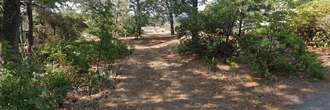
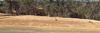
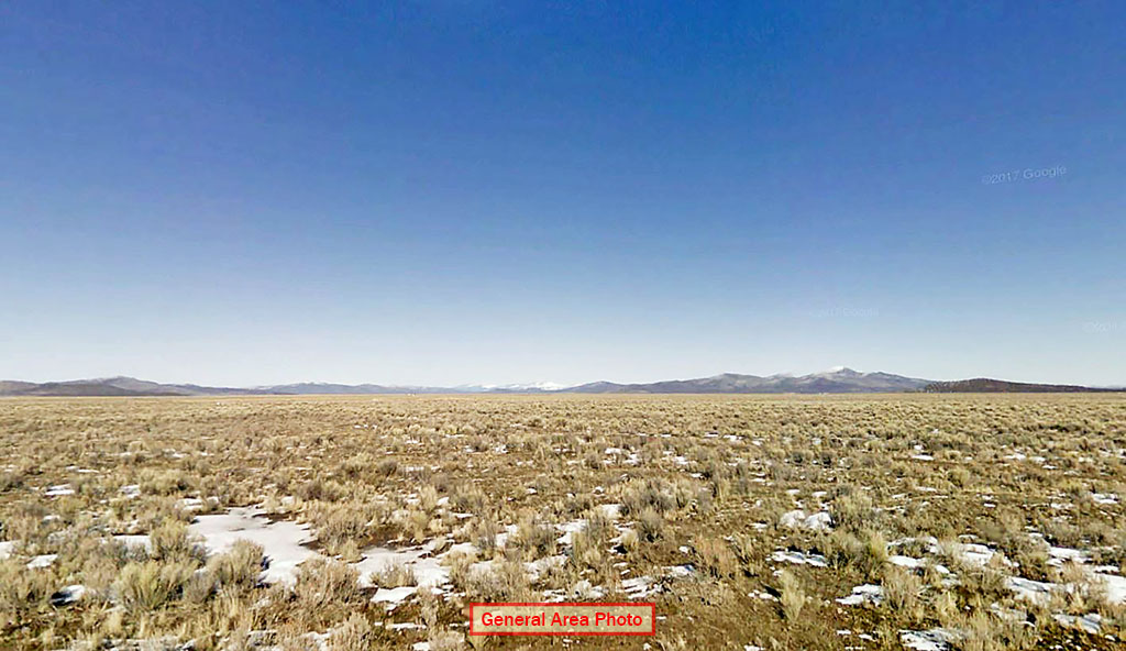
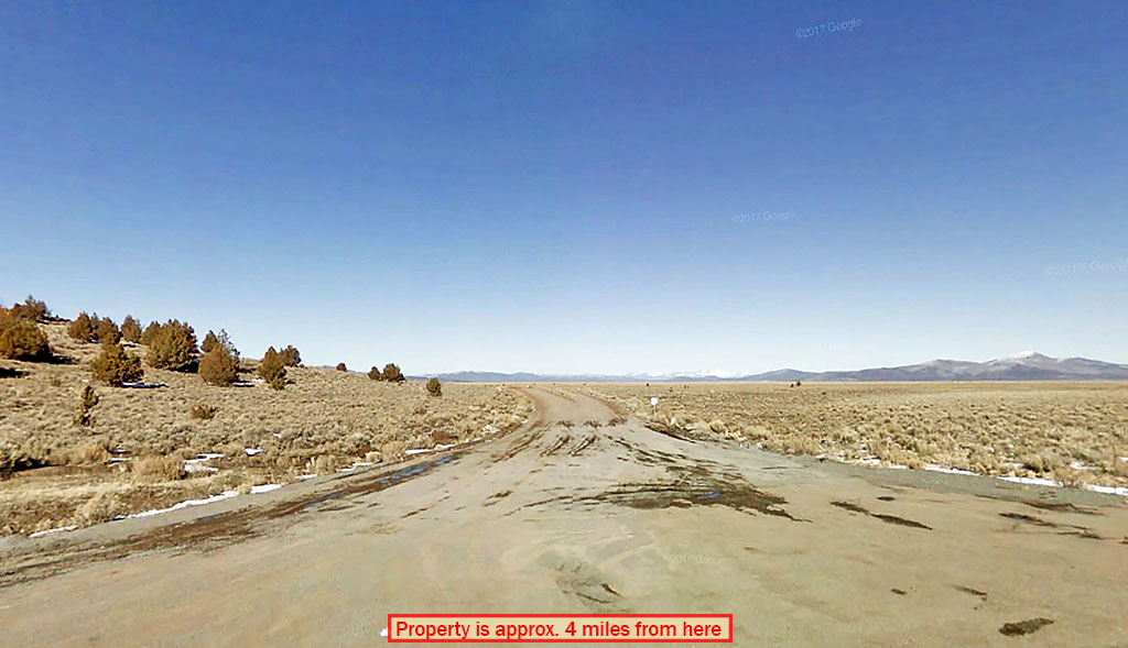
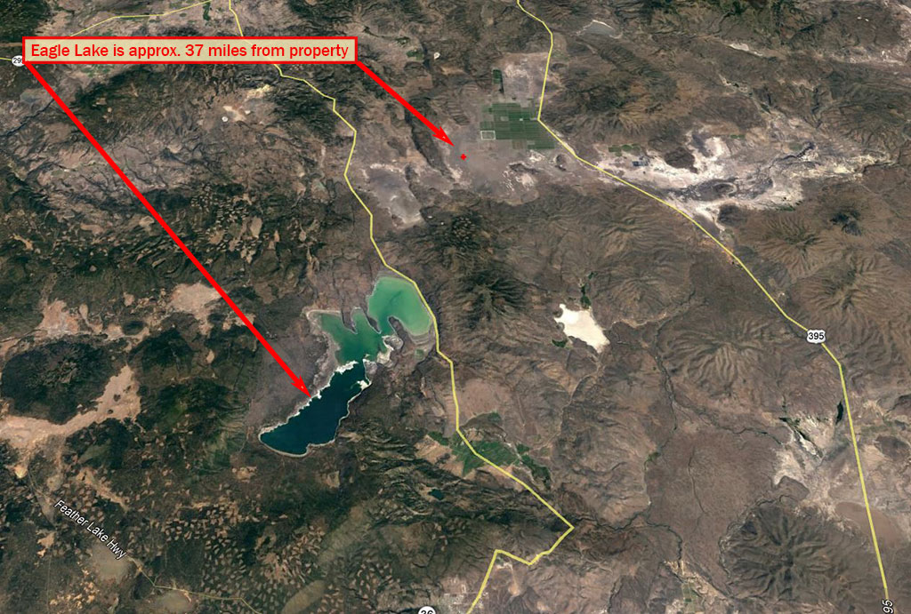
With wide open spaces and plenty of room to roam, this land has it all. 20.2 acres of cleared land with no neighbors in sight. The possibilities are endless! Located less than 5 miles from Grasshopper Ridge. The town of Termo is 8 miles east. Located less than 30 miles from the Nevada border, the property offers both beauty and convenience. Mountainous peaks surround the area, painting a natural backdrop full of beauty and wonder. With pristine air, natural surroundings and a small town community, this deal is a land owners dream!
Land Specifics
| Property Number | 10065 |
|---|---|
| Size | 20.20 acres |
| Dimensions | 665' x 1334' |
| Road Access | Dirt Road |
| Slope Description | Mostly Flat |
| Zoning | Forest / Conservation |
| Zoning Code | U-C-2 (Upland Conservation/Resource management) |
| Zoning Definition |
U-C-2 (Upland Conservation/Resource management): One single-family dwelling, farm buildings and accessory buildings and uses. A second single-family dwelling; provided that the dwelling is to be used in conjunction with an operating agricultural unit and is located on a parcel which meets the minimum parcel size criteria. General agriculture, crop and tree farming, logging, grazing, animal husbandry, general nurseries and greenhouses; |
| On Property Usage/Potential |
|
| Nearby Usage |
|
Location
| County | Lassen |
|---|---|
| State | California |
| Other Maps |
|---|
Additional Information
| Assessor Parcel Number (APN) | 043 120 26 11 |
|---|---|
| Estimated Annual Taxes | $125.00 |
| Legal Description |
The following described real property in the County of Lassen, State of California: Lot 124 as shown on that certain map entitled "Moon Valley Ranch Unit No. 3", filed February 9, 1970, in the office of the Lassen County Recorder, in Book 7 of Maps, at Page 45. Excepting therefrom and undivided Yi interest in and to all the oil, oil rights, mineral rights, natural gas rights and other hydrocarbon by whatsoever name known. Together with all geothermal steam and steam power that may be within or under said land as conveyed by deed to Eastwood Minerals EnergyCompany, a California Corporation, recorded December 26, 1974, in Book 285 of Official Records at Page 613, Lassen County, which deed provides as follows: "Together with the perpetual right of drilling, mining, exploring, and operation therefore and storing in and removing the same from said land, or any other land, including the right to whipstock or directionally drilled wells, tunnels, and to redrill, equip, maintain, repair, deepen and operate any such wells or mines, without however, the right to drill, mine, explore, and operate through or on the surface or the upper 500 feet of the subsurface of said land." A Notice of Intent to preserve interest executed by Eastwood Minerals and Energy Company, recorded April 25, 1994, in Book 595, Page 353 of Official Records. |
| Monthly HOA Dues | $0 |
| HOA | |
| HOA Dues | $0 |
| HOA Info |
This property has been sold.
This property is no longer available.
Use My LandCentral to be notified when a similar property is available in the future.
Or search available properties now:
Search Properties