

$0.00
0.21 acres | Residential Zoning
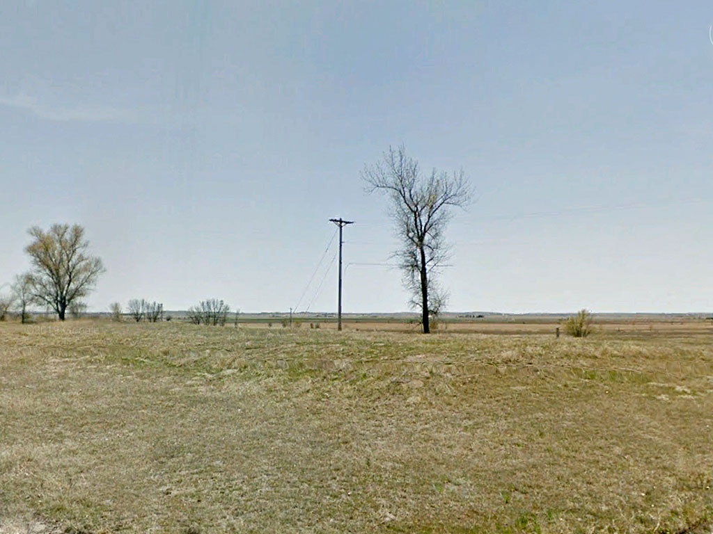
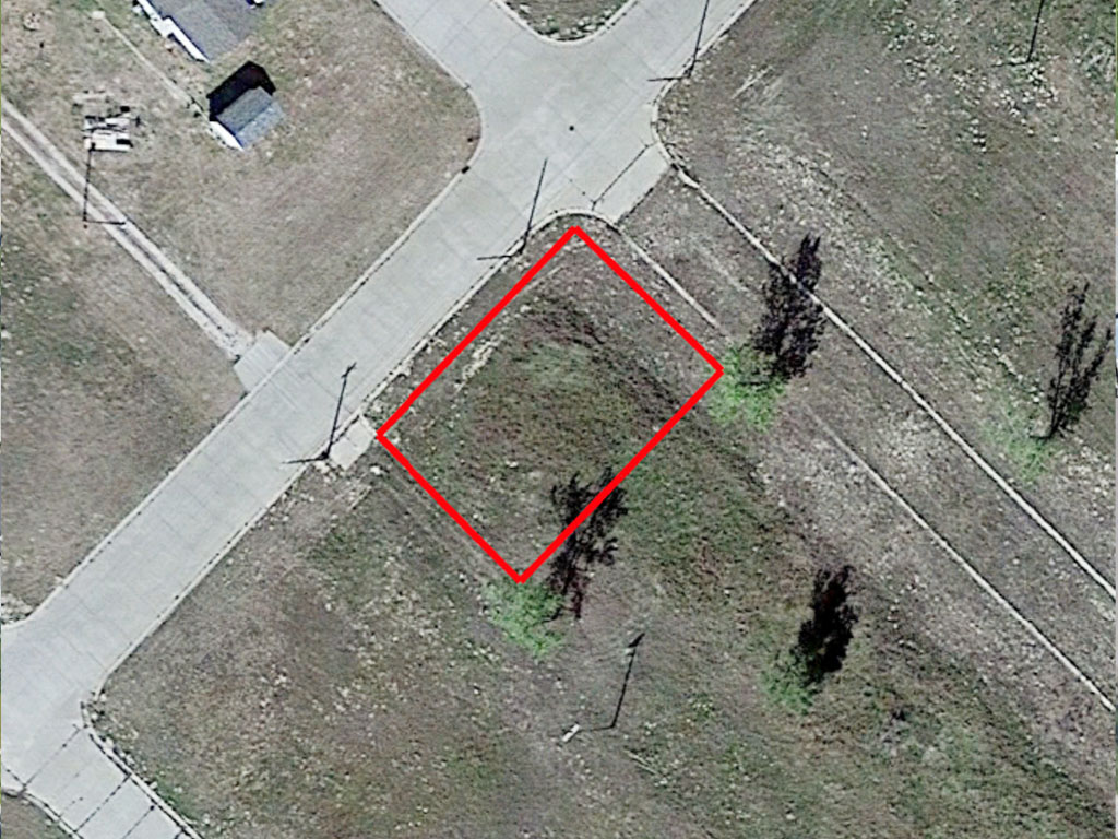
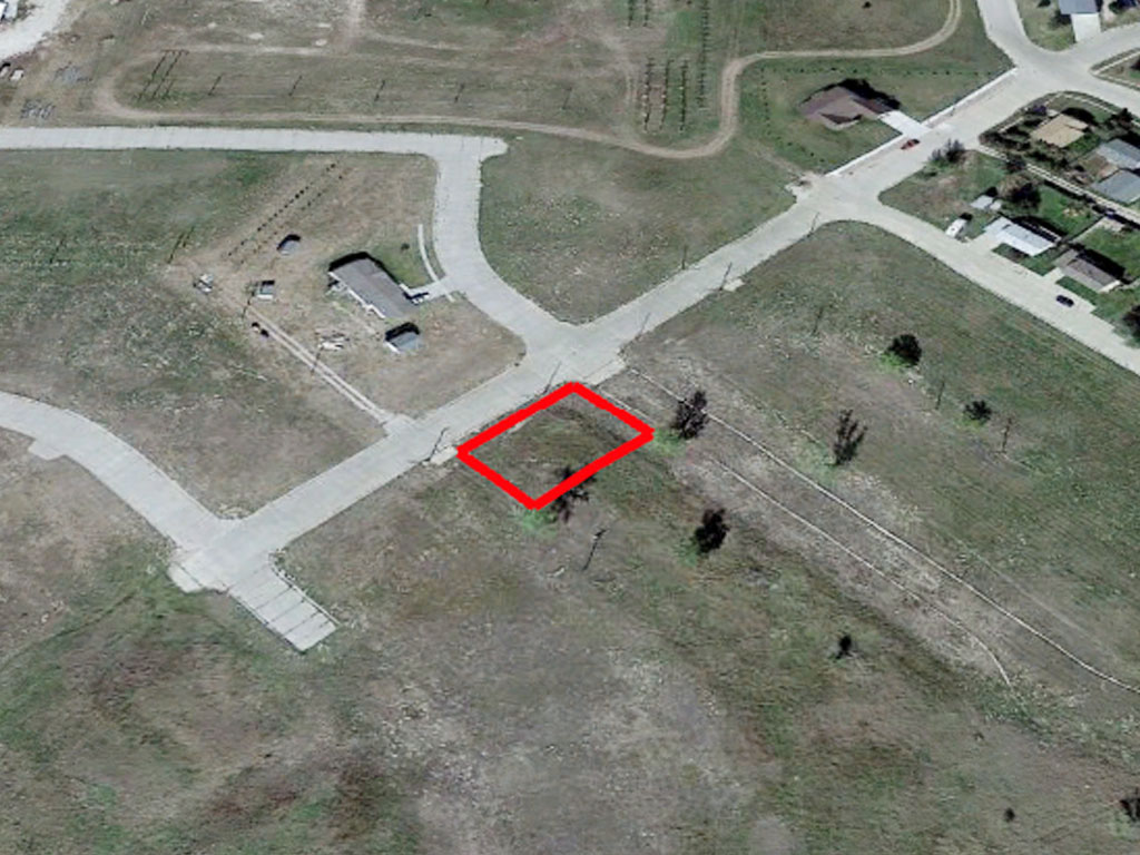
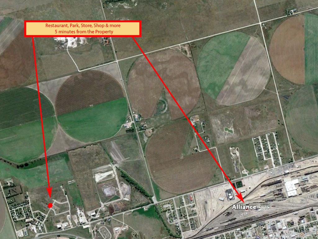
Along Alliance Street in Alliance, Nebraska you will find this nearly quarter acre property. The lot has recently been abated and is level and mostly cleared. The subdivision the property is located in only currently has one home built, though several in surrounding subdivisions. There is no HOA for the area though the property will still need to follow county/city zoning code. The code does allow for a single-family dwelling to be placed on the property. Power is currently running to the area though water may need to be drawn to the property still. This is a perfect blank canvas for the right person.
Land Specifics Foreclosed
| Property Number | 13473 |
|---|---|
| Size | 0.21 acres |
| Dimensions | 80.69' X 113.88' |
| Road Access | Paved Road |
| Slope Description | Mostly Flat |
| Zoning | Residential |
| Zoning Code | R-1a (Single-Family Residential) |
| Zoning Definition |
R-1a (Single-Family Residential): The R-1a, Single-Family Residential District is intended to provide a zone consisting primarily of one-family dwellings but may have recreational, religious, and educational facilities to create a balanced neighborhood. This zoning district is intended to accommodate recent and new subdivisions of the city with larger lot sizes and greater setbacks. |
| On Property Usage/Potential |
|
| Nearby Usage |
|
Location
| County | Box Butte |
|---|---|
| State | Nebraska |
| Other Maps |
|---|
Additional Information
| Assessor Parcel Number (APN) | 70028338 |
|---|---|
| Estimated Annual Taxes | $128.70 |
| Legal Description |
LOT 1 BLK 3 3RD ADD HOMESTEAD |
| Monthly HOA Dues | $0 |
| HOA | |
| HOA Dues | $0 |
| HOA Info |
This property has been sold.
This property is no longer available.
Use My LandCentral to be notified when a similar property is available in the future.
Or search available properties now:
Search Properties