
$4,697.00
0.13 acres | Residential Zoning
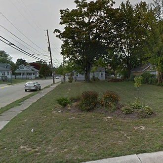
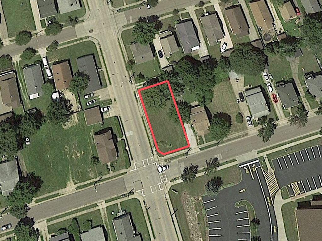
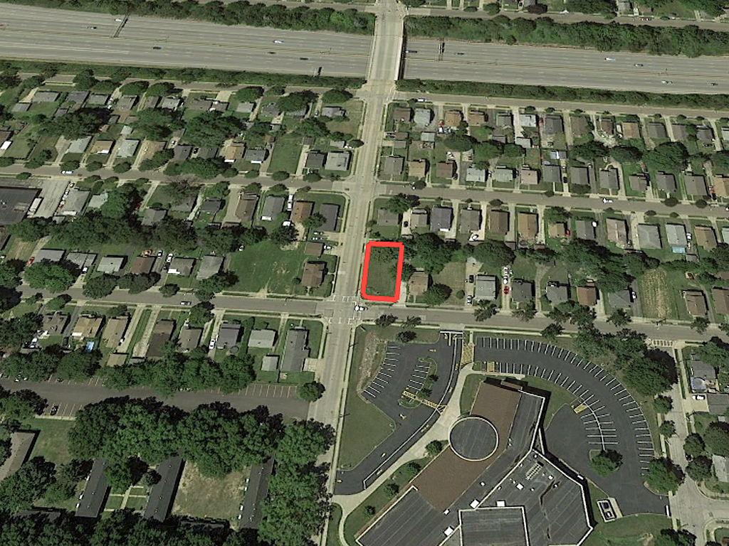
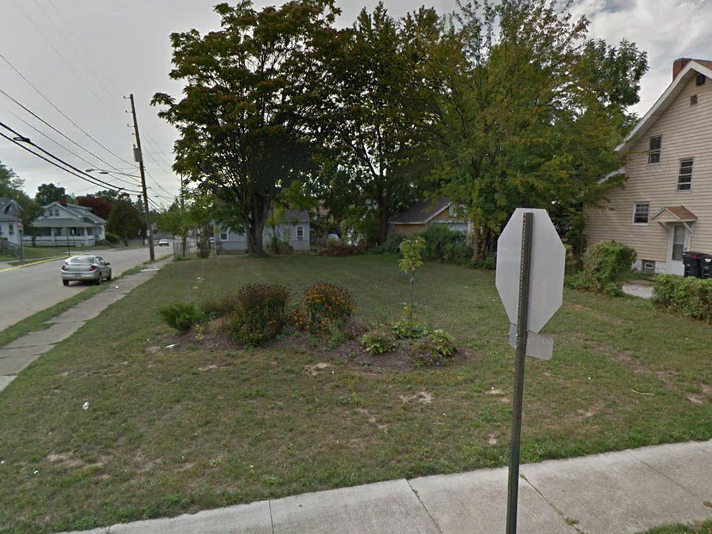
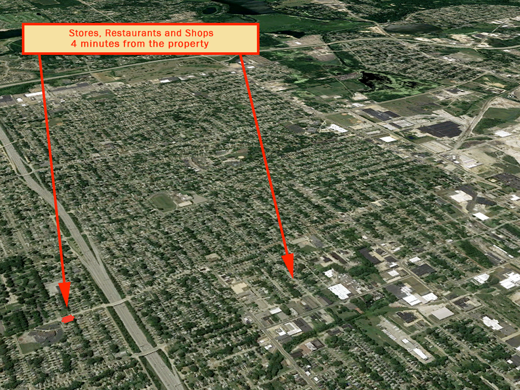
It should take very little work to get this lot ready to build. There used to be a house here so all utilities should be in place. This property is in a prime location, in a beautiful Akron neighborhood, across the street from the Glover Community Learning Center. You are surrounded by nice homes and well-maintained streets and sidewalks. Interstate 77 is only a few blocks away giving you easy access to commute to other parts of the city. Jump at this chance today!
Land Specifics
| Property Number | 10947 |
|---|---|
| Size | 0.13 acres |
| Dimensions | 110' x 40' x 10' x 102' x 49' |
| Road Access | Paved Road |
| Slope Description | Mostly Flat |
| Zoning | Residential |
| Zoning Code | U-1 (Single Family) |
| Zoning Definition |
Single Family Dwellings are permitted. Minimum lot square footage of 4,000 square feet. |
| On Property Usage/Potential |
|
| Nearby Usage |
|
Location
| County | Summit |
|---|---|
| State | Ohio |
| Other Maps |
|---|
Additional Information
| Assessor Parcel Number (APN) | 67 32171 |
|---|---|
| Estimated Annual Taxes | $98.50 |
| Legal Description |
Situated in the City of Akron, County of Summit and State of Ohio and known as being all of Lot Number Four Hundred Sixty-Eight (468) in the Dye and Allen First Addition to Lovers Lane Allotment, as recorded in Plat Book 18, Page 28 of Summit County Plat Records. Excepting therefrom the following described parcel: Beginning at a point of intersection of the northerly line of Colve Avenue (formerly Currie Ave) and the westerly line of Hammel Street, which point is also the true place of beginning for the parcel hereinafter described; thence in a Northerly direction and along the Easterly line of Lot No. 468 (and the westerly line of Hammel Street), 4.93 feet to a point of Tangency in the easterly line of Lot No. 468 (the westerly line of Hammel Street); thence Southwesterly along the arc of a circle, curving to the right (central angle 89 deg 15' radius, 5 feet, chord 7.02 feet), 7.79 feet to a point of tangency in the southerly line of Lot No. 468 (and thr northerly line of Cole Avenue), 4.93 feet to the true place of beginning and containing 5.204 square feet of land, more or less. Also excepting thereform the following described parcel: part of Lot No. 468 in the Dye and Allen First Addition to Lovers Lane Alltoment, Plat Book 18 Page 28 of the Summit County Records of Plats and being a corner chamfer needed for sidewalk purposes more fully described as follows: the Point of Origin being the intersection of the northerly line of Cole Avenue (45' R/W) and the westerly line of Hammel Street (45' R/W); thence Southwesterly along the northerly line of Cole Avenue (45' R/W) S 89 deg 27'53" W 4.92 feet to the True Place of Beginning; thence continuing along the northerly line of Cole Avenue (45' r/W) S 89 deg 27' 53" W 2.08 feet to a point; thence Northeasterly through Lot No 468, N 44 deg 54' 07" E 9.97 feet to the westerly line of Hammel Street (45' R/W); then Southwesterly along the westerly line of Hammel Street (45' R/W) S 00 deg 20'21" W, 2.08 feet to a point on a curve. |
| Monthly HOA Dues | $0 |
| HOA | |
| HOA Dues | $0 |
| HOA Info |
This property has been sold.
This property is no longer available.
Use My LandCentral to be notified when a similar property is available in the future.
Or search available properties now:
Search Properties