$1,760.88
0.50 acres | Residential Zoning
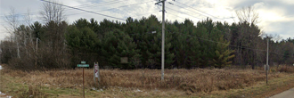
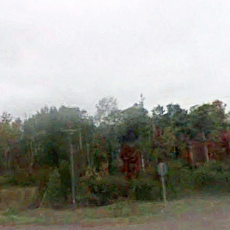
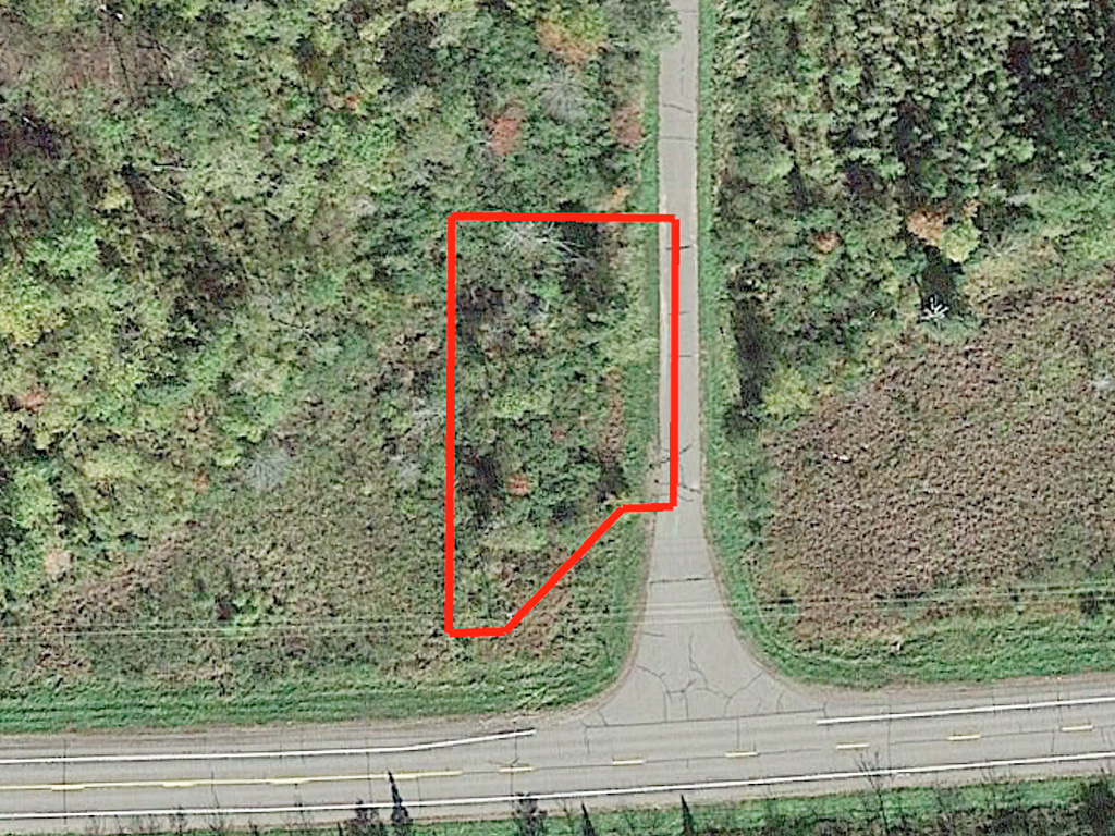
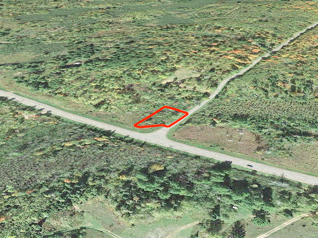
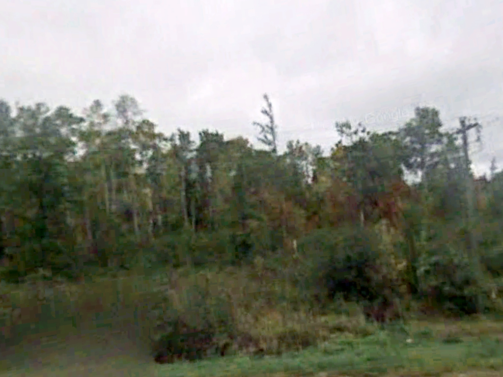
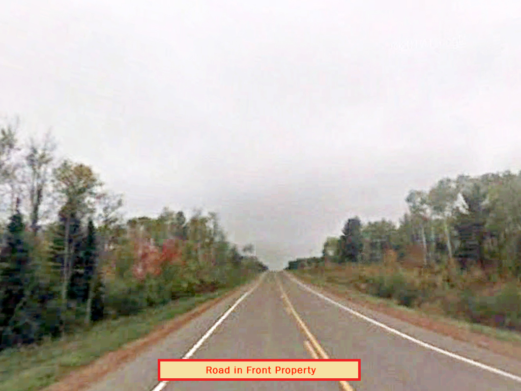
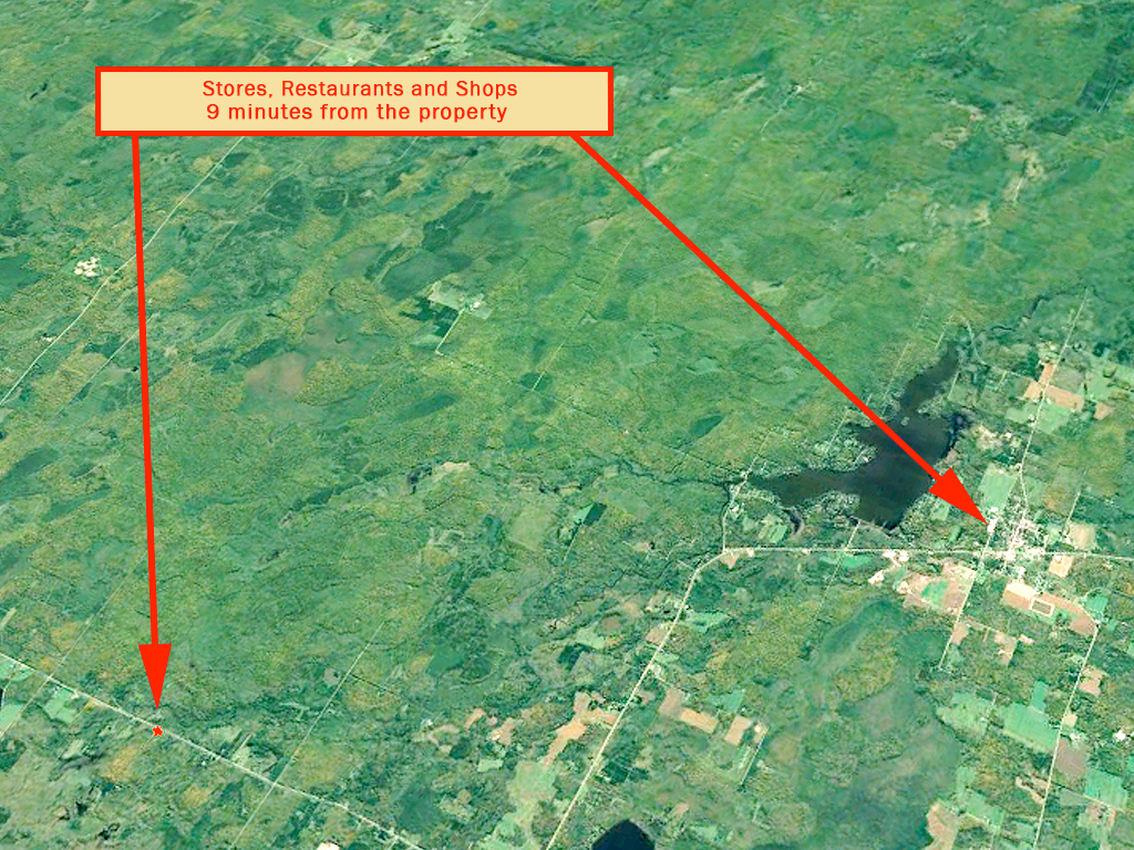
From outdoor adventure to a thriving food scene, Wisconsin has it all. This 21,780 sq. ft. parcel is a solid half acre with plenty of room for your dream home. A large lot conveniently located off State Route 70, this parcel allows for Mobile Homes and RV use with a Special Permit. With power available and paved road access, you’ll find everything you need to begin your new life. Less than 2 miles from Black Dan Lake and Loretta Lake and less than an hour’s drive to the famed Lake Superior. Ready to call Wisconsin home? Then seize this deal before it’s gone.
Land Specifics Foreclosed
| Property Number | 11152 |
|---|---|
| Size | 0.50 acres |
| Dimensions | 99.54' x 128.69' x 22.94' x 75.10' x 26.16' x 184.13' |
| Road Access | Paved Road |
| Slope Description | Mostly Flat |
| Zoning | Residential |
| Zoning Code | RR-1 (Residential/Recreational One) |
| Zoning Definition |
RR-1 (Residential/Recreational One): This zone is primarily made up of residential dwellings and locations of residential dwellings. Mobile homes are allowed with special permits, this is also the case with RV usage. Single-Family dwellings are allowed. No building permanent or not shall exceed 35ft. |
| On Property Usage/Potential |
|
| Nearby Usage |
|
Location
| County | Sawyer |
|---|---|
| State | Wisconsin |
| Other Maps |
|---|
Additional Information
| Assessor Parcel Number (APN) | 57 006 2 39 04 06 4 04 000 000020 |
|---|---|
| Estimated Annual Taxes | $14.78 |
| Legal Description |
That part of the SE 1/4 of the SE 1/4 of Section 6, Township 39 North, Range 4 West, described as beginning at southeast corner of said section, running thence north along the east section line a distance of 250'; then west at right angles a distance of 100'; thence south keeping parallel with the east section line a distance of 250', more or less, to the south line of said section; thence east along said south section line a distance of 100' to the point of beginning; EXCPETING THE FOLLOWING: Beginning at the Southwest Corner of Section 6; thence along the West line of Section 6, N02 deg. 04'01" E, 111.38 feet; thence N81 deg. 51'11" E 33.87 feet to a point on the north right of way line of S.T.H. 70; thence S43 deg. 17'51" E 97.36 feet; thence Easterly along the arc of a curve to the right; Radius, 2914.79 feet; Central Angle, 02 deg. 10'29"; Chord Bearing S89 deg. 35'46" E; Chord 110.63 feet; thence S 88 deg. 30'57" 839.91 feet; thence N 87 deg. 40'18" E 150.33 feet; thence S84 deg. 42'09" E 150.33 feet; thence S 88 deg. 30'57" E 200.00 feet; thence N 87 deg. 41'57" E 300.66 feet; thence S 88 deg. 30'57" E 600.00 feet; thence N 88 deg. 37'43" E 100.13 feet; thence S 88 deg. 30'57" E 600.00 feet; thence S 82 deg. 48'01" E 100.50 feet; thence S 88 deg. 30'57" E 1788.09 feet; thence Easterly along the arc of a curve to the left; Radius 7574.44 feet; Central Angle, 01 deg. 49'30"; Chord Bearing S 89 deg. 25'23" E; Chord 241.25 feet; thence N 46 deg. 05'57" E 75.77 feet; thence S 86 deg. 55'52" E 23.32 feet to a point on the East line of Section 6; thence S03°04'08"W, 122.21 feet to the Southeast Corner of Section 6; thence S00°52'01"E, 63.51 feet to a point on the south right of way line of S.T.H. 70; thence Westerly along the arc of a curve to the right; Radius, 7709.44 feet; Central Angle, 02°21'23"; Chord Bearing, N89°41'28"W; Chord, 317.06 feet; thence N88°30'37"W, 388.09 feet; thence S88°37'35"W, 100.12 feet; thence N88°30'37"W, 1000.00 feet; thence S81°33'48"W, 203.04 feet; thence N88°30'37"W, 200.00 feet; thence N69°13'13"W, 105.95 feet; thence N88°30'37"W, 900.00 feet; thence N61°56'43"W, 55.90 feet; thence N88°30'37"W, 150.00 feet; thence S77°27'10"W, 103.07 feet; thence N88°30'37"W, 100.00 feet; thence N79°58'57"W, 101.12 feet; thence N88°30'37"W, 1,439.91 feet; thence N01°29'23"E, 10.00 feet; thence Westerly along the arc of a curve to the left; Radius, 2,814.79 feet; Central Angle, 02°20'11"; Chord Bearing, N89°40'SO"W; Chord, 114.77 feet; thence S46°07'3S"W, 90.86 feet; thence S84°13'47"W, 34.41 feet to a point on the West line of Section 7; thence N01 deg. 00'52"E, 121.31 feet back to the Point of Beginning. Said parcel lying wholly within the Southeast quarter of the Southeast quarter of -said Section, Township and Range. |
| Monthly HOA Dues | $0 |
| HOA | |
| HOA Dues | $0 |
| HOA Info |
This property has been sold.
This property is no longer available.
Use My LandCentral to be notified when a similar property is available in the future.
Or search available properties now:
Search Properties